TOKYO HIKING
TOKYO HIKING

Contact us.

Location

Google map

The Plateau in the Clouds | Hiking to Kumo-no-Daira in Japanese Northern Alps

The Plateau in the Clouds | Hiking to Kumo-no-Daira in Japanese Northern Alps

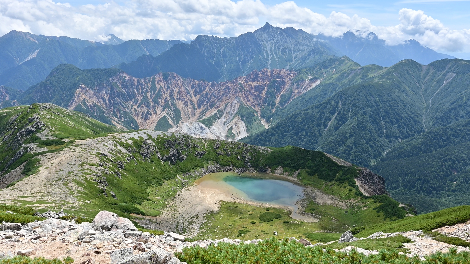
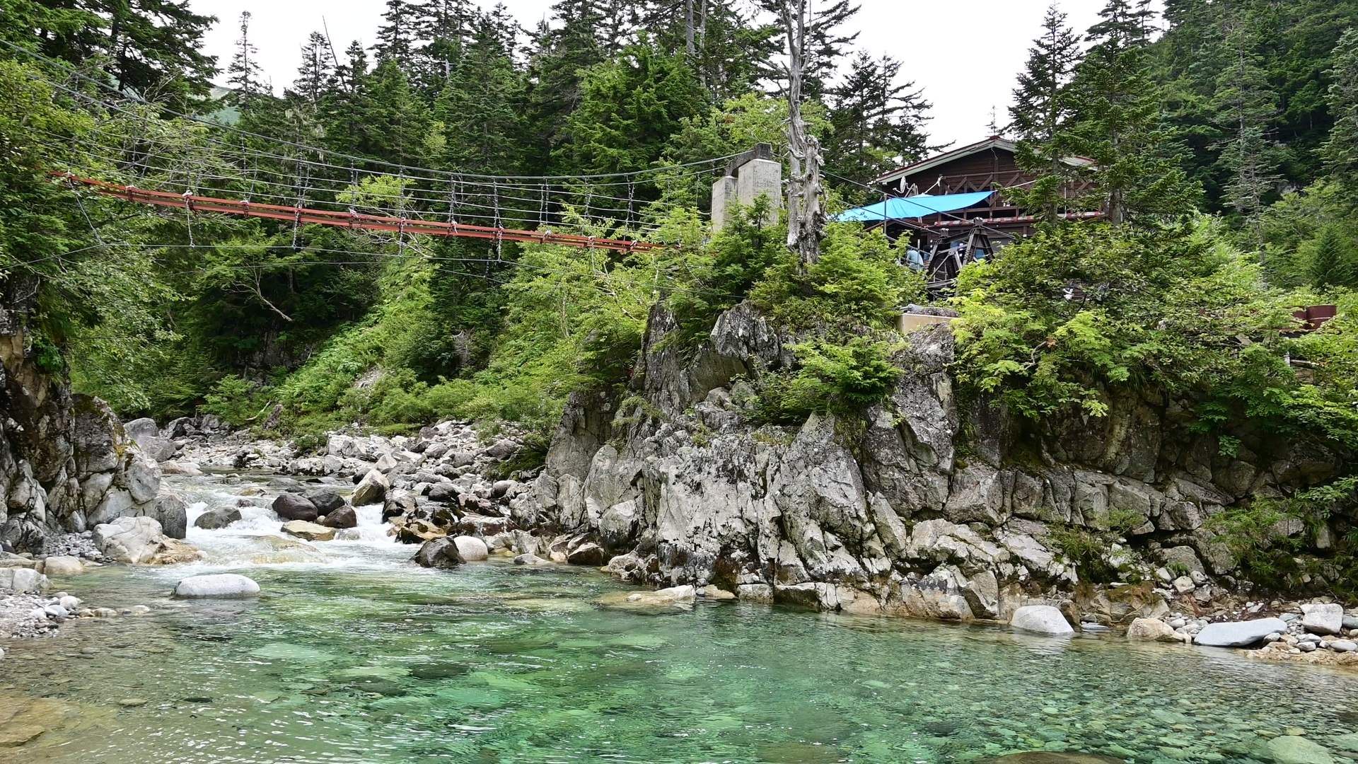
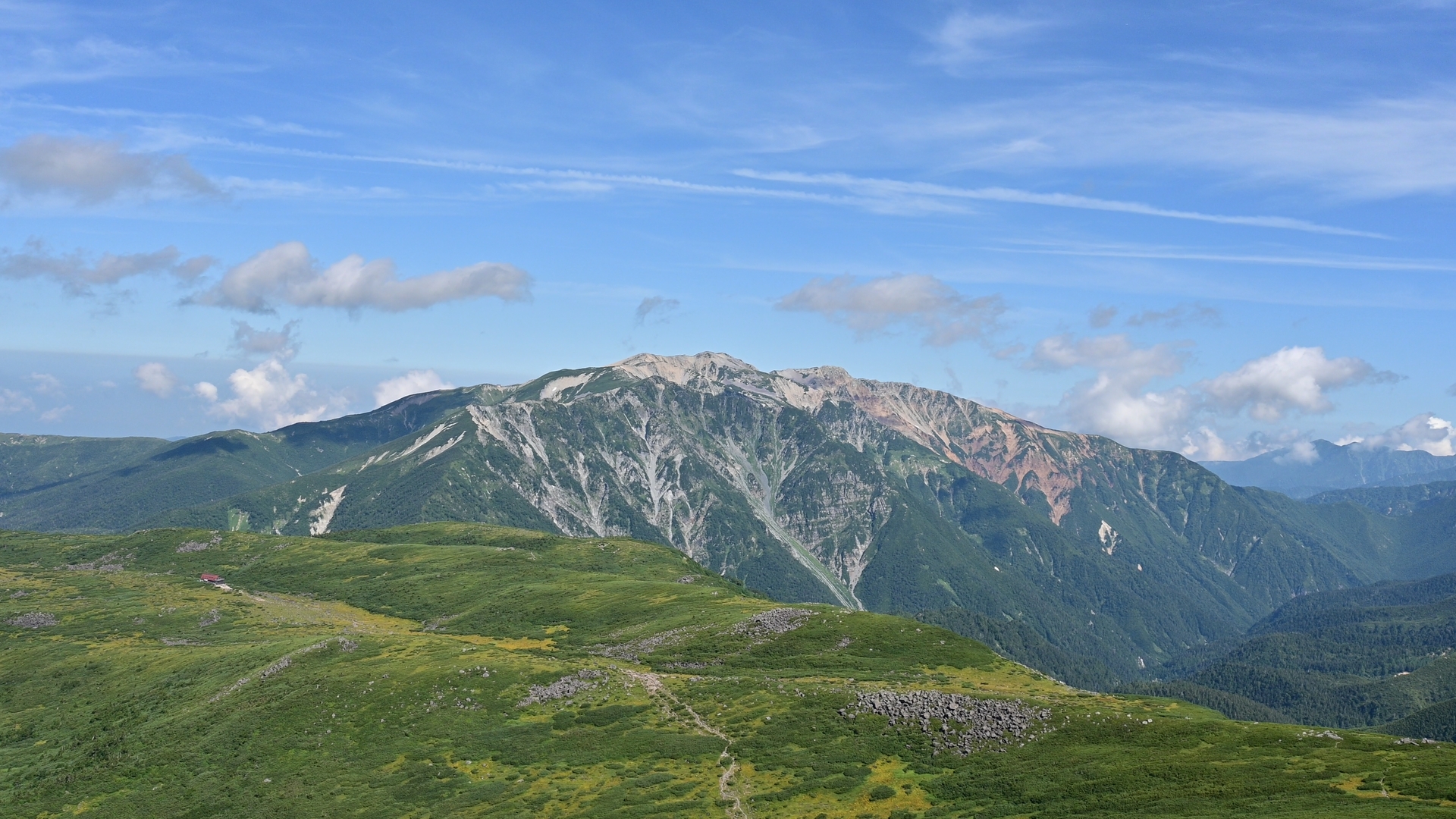
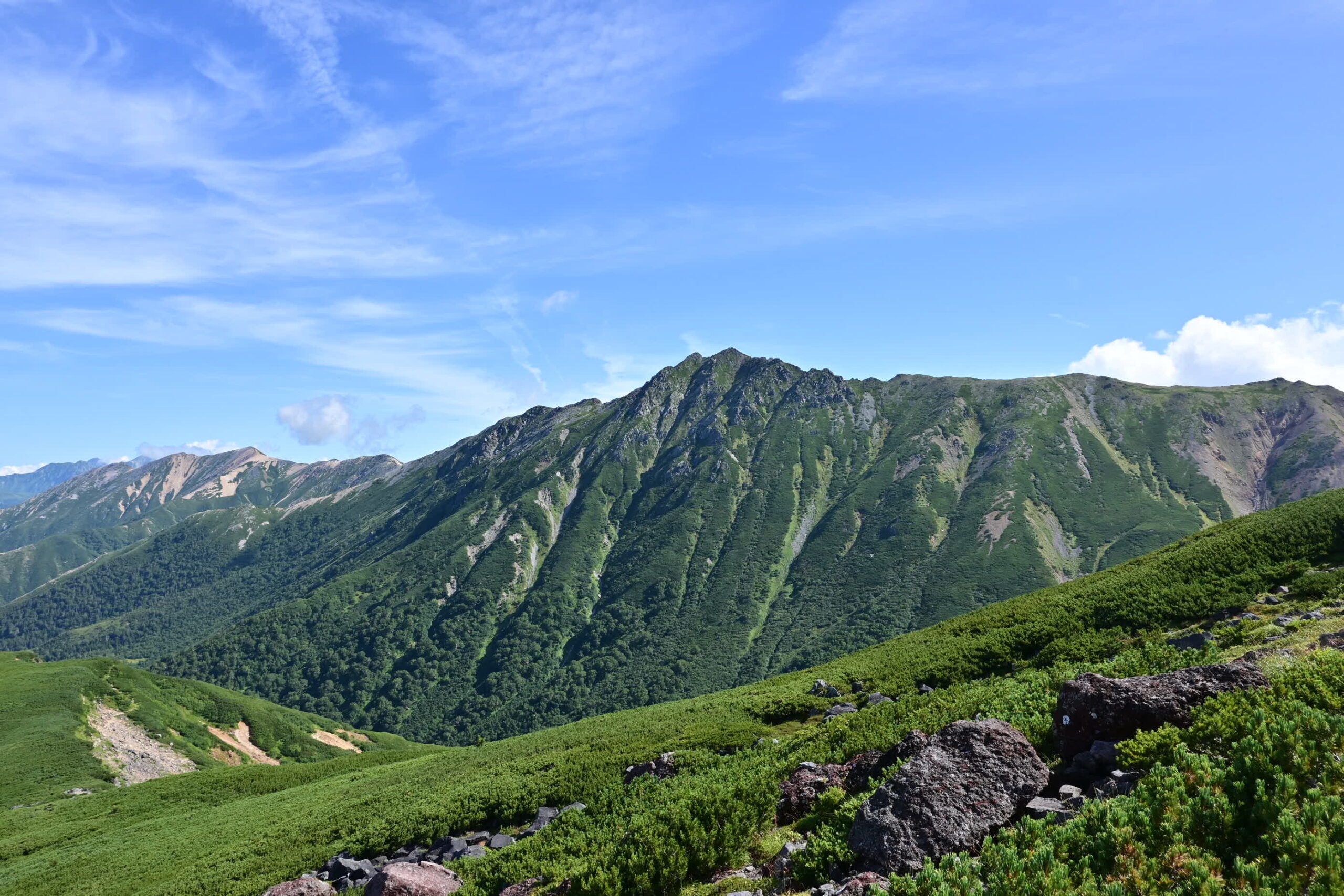
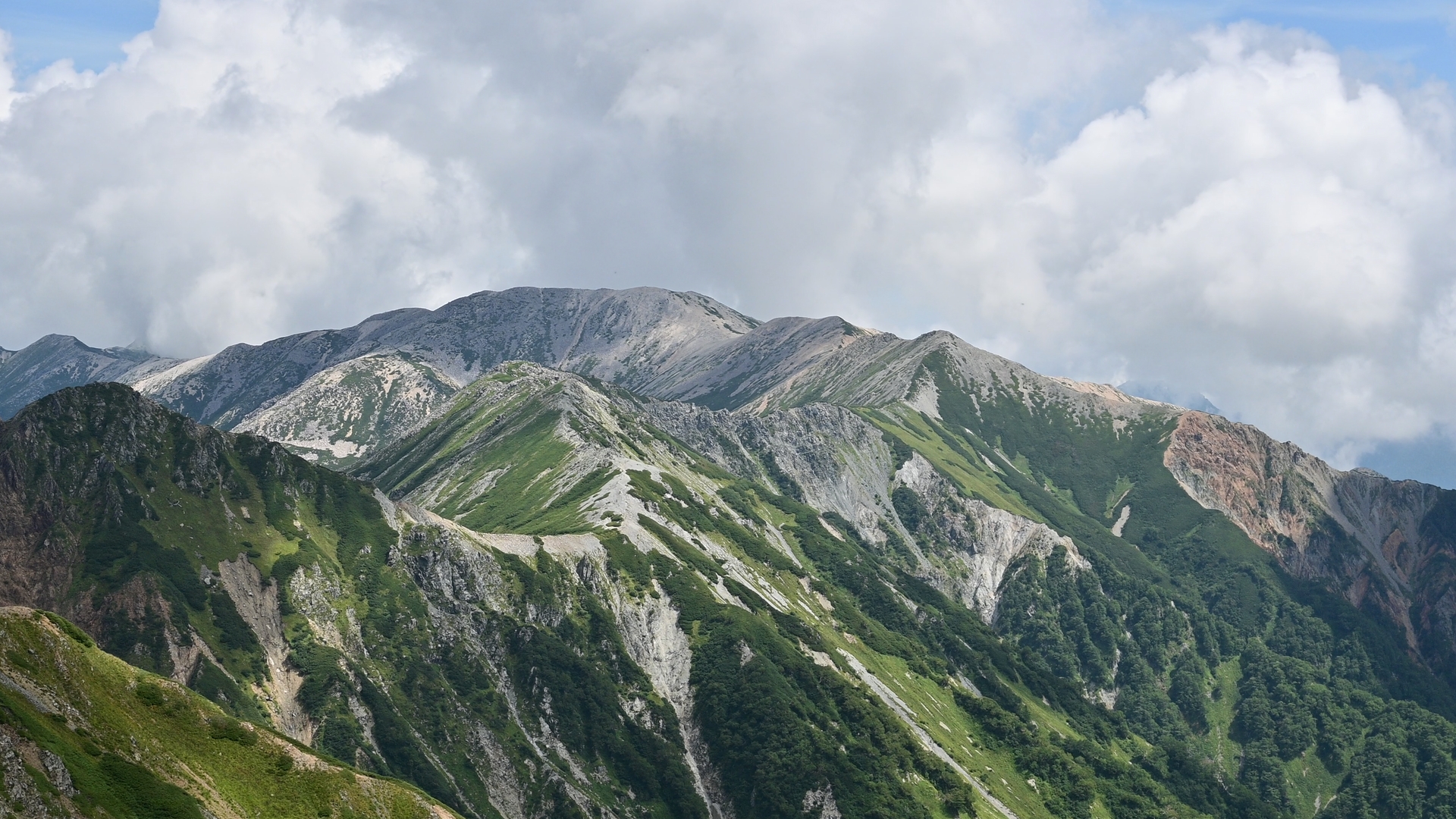
For us local hikers in Japan, talking about Kumo-no-Daira inevitably brings a sense of longing and nostalgia. Kumo-no-Daira is a remote plateau, encircled by the headwaters of the Kurobe River and Japan’s highest peaks above 3,000 meters, and reaching it means days of relentless ascents and descents. Therefore, Kumo-no-Daira, literally “the plateau in the clouds”, has become a place that many Japanese hikers dream of visiting one day.

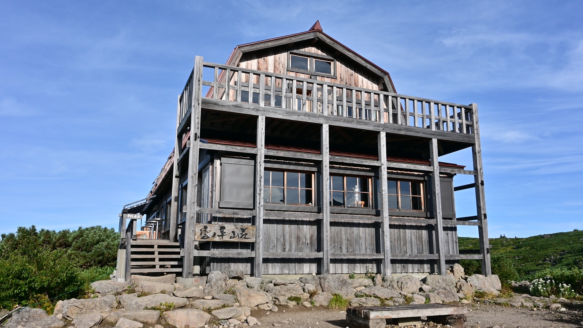
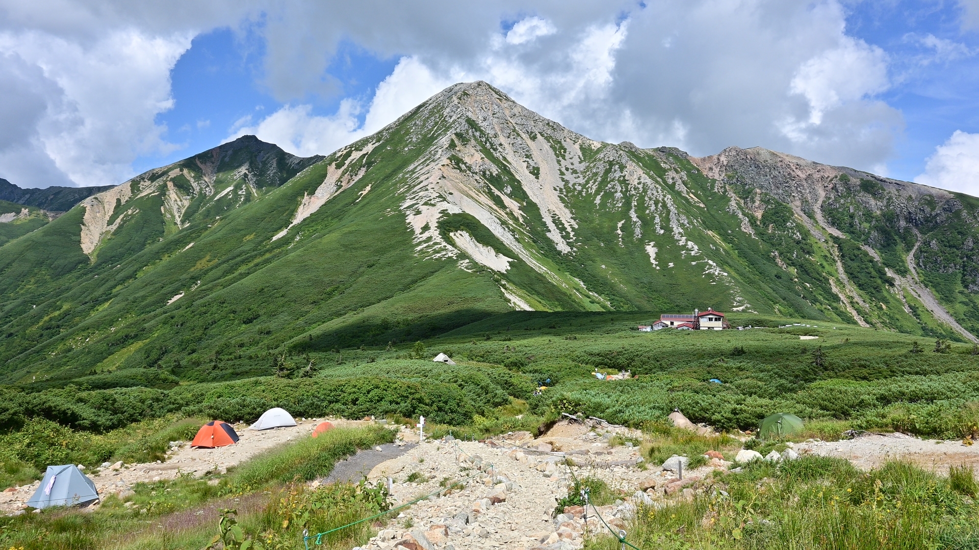
Accordingly, reaching Kumo-no-Daira has become increasingly difficult, as hiking is booming in Japan while the capacity of mountain huts and campsites remains limited. During the summer season, it is nearly impossible to book a hut—especially on weekends—unless you secure a reservation the moment online booking opens, as spots often sell out within an hour.

Campsites also need to be reserved, but they are generally easier to secure than mountain huts. As a result, when planning a trip to Kumo-no-Daira, we often consider multi-night camping as a realistic alternative. It is clearly challenging for international tourists without local support, and it remains challenging even for locals. Therefore, it is essential to plan well in advance when hiking to this remote plateau.

There are three major trailheads for accessing Kumo-no-Daira: Oritate in Toyama Prefecture, Shin-Hodaka on the Gifu side, and Takase Dam in Nagano. Among them, Oritate is the most popular and convenient, as it offers the shortest route to the plateau. However, the only realistic way to reach Oritate is by car, and with limited parking and nighttime road closures, the itinerary must be carefully planned. 01
There are three major trailheads for accessing Kumo-no-Daira: Oritate in Toyama Prefecture, Shin-Hodaka on the Gifu side, and Takase Dam in Nagano. Among them, Oritate is the most popular and convenient, as it offers the shortest route to the plateau. However, the only realistic way to reach Oritate is by car, and with limited parking and nighttime road closures, the itinerary must be carefully planned. 02
There are three major trailheads for accessing Kumo-no-Daira: Oritate in Toyama Prefecture, Shin-Hodaka on the Gifu side, and Takase Dam in Nagano. Among them, Oritate is the most popular and convenient, as it offers the shortest route to the plateau. However, the only realistic way to reach Oritate is by car, and with limited parking and nighttime road closures, the itinerary must be carefully planned.
The first major milestone after starting from Oritate is Taro-daira, a broad saddle between Mt. Kurobe-Goro and Mt. Yakushi. There is a hut where you can stay overnight, a campsite nearby that can accommodate 20..30 tents, and a kitchen that serves ramen or curry rice for lunch. You can use these facilities depending on your itinerary. 01
The first major milestone after starting from Oritate is Taro-daira, a broad saddle between Mt. Kurobe-Goro and Mt. Yakushi. There is a hut where you can stay overnight, a campsite nearby that can accommodate 20..30 tents, and a kitchen that serves ramen or curry rice for lunch. You can use these facilities depending on your itinerary. 02
The first major milestone after starting from Oritate is Taro-daira, a broad saddle between Mt. Kurobe-Goro and Mt. Yakushi. There is a hut where you can stay overnight, a campsite nearby that can accommodate 20..30 tents, and a kitchen that serves ramen or curry rice for lunch. You can use these facilities depending on your itinerary.
There are around eight mountain huts around Kumo-no-Daira, Taro-Daira-Goya, Yakushi-Dake-Sanso, Yakushi-Zawa-Goya, Kumo-no-Daira-Sanso, Takamagahara-Sanso, Suisho-Goya, Mitsumata-Sanso, Kuroba-Goro-Goya, they are distributed to cover this mountain range safely. But again, it is very difficult to book them to fit to your itinerary, even with a couple of different operators with different booking systems. Even Japanese locals cannot make it through.<br />
<br />
This difficulty can lead to tight schedules or even dangerous plans, so having the option to camp is important to be on safe side. 01
There are around eight mountain huts around Kumo-no-Daira, Taro-Daira-Goya, Yakushi-Dake-Sanso, Yakushi-Zawa-Goya, Kumo-no-Daira-Sanso, Takamagahara-Sanso, Suisho-Goya, Mitsumata-Sanso, Kuroba-Goro-Goya, they are distributed to cover this mountain range safely. But again, it is very difficult to book them to fit to your itinerary, even with a couple of different operators with different booking systems. Even Japanese locals cannot make it through.<br />
<br />
This difficulty can lead to tight schedules or even dangerous plans, so having the option to camp is important to be on safe side. 02
There are around eight mountain huts around Kumo-no-Daira, Taro-Daira-Goya, Yakushi-Dake-Sanso, Yakushi-Zawa-Goya, Kumo-no-Daira-Sanso, Takamagahara-Sanso, Suisho-Goya, Mitsumata-Sanso, Kuroba-Goro-Goya, they are distributed to cover this mountain range safely. But again, it is very difficult to book them to fit to your itinerary, even with a couple of different operators with different booking systems. Even Japanese locals cannot make it through.

This difficulty can lead to tight schedules or even dangerous plans, so having the option to camp is important to be on safe side.
The landscape of Kumo-no-Daira is breathtaking. Whenever I come to this place, I feel like I could stay here forever and never hike back down to civilization.<br />
Mt. Yakushi, a giant peak to the northwest of Kumo-no-Daira, rises to an elevation of 2,926 meters. Mt. Suisho lies to the east and reaches 2,986 meters, with its iconic buttress. 01
The landscape of Kumo-no-Daira is breathtaking. Whenever I come to this place, I feel like I could stay here forever and never hike back down to civilization.<br />
Mt. Yakushi, a giant peak to the northwest of Kumo-no-Daira, rises to an elevation of 2,926 meters. Mt. Suisho lies to the east and reaches 2,986 meters, with its iconic buttress. 02
The landscape of Kumo-no-Daira is breathtaking. Whenever I come to this place, I feel like I could stay here forever and never hike back down to civilization.
Mt. Yakushi, a giant peak to the northwest of Kumo-no-Daira, rises to an elevation of 2,926 meters. Mt. Suisho lies to the east and reaches 2,986 meters, with its iconic buttress.
Mt. Noguchi-Goro, a broad peak with an elevation of 2,924 meters, lies far to the east. Mt. Washiba, whose name literally means “eagle wing,” spreads its ridges like outstretched wings at Kurobe's headwaters. And there is a small volcanic crater lake below its summit.<br />
However, the scenery depends greatly on the weather. If you have enough spare days during your stay in Japan, I would highly recommend staying in Kumo-no-Daira for a couple of days and climbing the surrounding peaks. Then the probability to enjoy good weather will be increased. 01
Mt. Noguchi-Goro, a broad peak with an elevation of 2,924 meters, lies far to the east. Mt. Washiba, whose name literally means “eagle wing,” spreads its ridges like outstretched wings at Kurobe's headwaters. And there is a small volcanic crater lake below its summit.<br />
However, the scenery depends greatly on the weather. If you have enough spare days during your stay in Japan, I would highly recommend staying in Kumo-no-Daira for a couple of days and climbing the surrounding peaks. Then the probability to enjoy good weather will be increased. 02
Mt. Noguchi-Goro, a broad peak with an elevation of 2,924 meters, lies far to the east. Mt. Washiba, whose name literally means “eagle wing,” spreads its ridges like outstretched wings at Kurobe's headwaters. And there is a small volcanic crater lake below its summit.
However, the scenery depends greatly on the weather. If you have enough spare days during your stay in Japan, I would highly recommend staying in Kumo-no-Daira for a couple of days and climbing the surrounding peaks. Then the probability to enjoy good weather will be increased.
The highlight of this hike may be the cirque of Mt. Kurobe-Goro, located on the southern rim of Kurobe's headwaters. Directly from the pyramidal peak of Mt. Kurobe-Goro lies the largest cirque, which drops steeply down to the riverbed of the Kurobe River. This combination of glacial and volcanic terrain is a distinctive feature of this range, and more broadly, of the Japanese Alps. 01
The highlight of this hike may be the cirque of Mt. Kurobe-Goro, located on the southern rim of Kurobe's headwaters. Directly from the pyramidal peak of Mt. Kurobe-Goro lies the largest cirque, which drops steeply down to the riverbed of the Kurobe River. This combination of glacial and volcanic terrain is a distinctive feature of this range, and more broadly, of the Japanese Alps. 02
The highlight of this hike may be the cirque of Mt. Kurobe-Goro, located on the southern rim of Kurobe's headwaters. Directly from the pyramidal peak of Mt. Kurobe-Goro lies the largest cirque, which drops steeply down to the riverbed of the Kurobe River. This combination of glacial and volcanic terrain is a distinctive feature of this range, and more broadly, of the Japanese Alps.
After completing the big loop around Kumo-no-Daira, the trail returns to the Oritate trailhead.<br />
We visited Kumo-no-Daira last time in mid-August and already noticed subtle signs of autumn. Hiking to Kumo-no-Daira in autumn, especially from mid-September onward, is also very appealing, with the mountainsides glowing in vivid reds and yellows. Planning becomes more challenging with shorter daylight hours, but it is well worth the effort. 01
After completing the big loop around Kumo-no-Daira, the trail returns to the Oritate trailhead.<br />
We visited Kumo-no-Daira last time in mid-August and already noticed subtle signs of autumn. Hiking to Kumo-no-Daira in autumn, especially from mid-September onward, is also very appealing, with the mountainsides glowing in vivid reds and yellows. Planning becomes more challenging with shorter daylight hours, but it is well worth the effort. 02
After completing the big loop around Kumo-no-Daira, the trail returns to the Oritate trailhead.
We visited Kumo-no-Daira last time in mid-August and already noticed subtle signs of autumn. Hiking to Kumo-no-Daira in autumn, especially from mid-September onward, is also very appealing, with the mountainsides glowing in vivid reds and yellows. Planning becomes more challenging with shorter daylight hours, but it is well worth the effort.


Kumonodaira / Kojiさんの活動データ | YAMAP / ヤマップ
TOPへ戻る

WALK WITH US!

SUSTAINABILITY

SUSTAINABILITY

We promote sustainable tourism in collaboration with guests who embrace the vision, emphasizing respect for and enjoyment of the environment, culture, and economy of the regions we visit.

COMFORT

COMFORT

We do our best to mitigate “over-tourism” by exploring less-traveled but captivating destinations - mainly for the comfort of our guests but also for the communities affected by overcrowded attractions.

CULTURE & NATURE

CULTURE & NATURE

We integrate “Nature & Culture” into our service by visiting cultural sites and savoring local cuisine on our way to hiking destinations.

RESPONSIBILITY

RESPONSIBILITY

We contribute 10% of our profits to the regions we frequently visit.